Information about the Magallanes Region, gateway to the white continent.
The Region of Magallanes and Antártica Chilena is located in the extreme south of the national territory, being the most extensive and the second least populated of the country. Inserted in this region is the so-called Southern Patagonia and Tierra del Fuego, which constitute a magical territory where every corner hides incredible surprises. These are distant and remote places where you learn to listen to the silence and experience the magnitude of nature.
Crossed by the Patagonian Andes, this mountain range gives way to a landscape of incomparable beauty where fjords, lakes, ice fields and mountain peaks alternate, to then sink into the sea in the majestic island of Tierra del Fuego. To the west and southwest of Los Andes mountain range, a vast area of archipelagos develops, formed by islands, islets and rocky crags, which form a geographical labyrinth that is among the most extensive and beautiful on Earth. Another form of relief found in Magallanes is the Patagonian steppe or pampas. They are vast and flat lands, covered with pastures, which makes them a typical livestock area of the region. On the other hand, there are extensive forests of nothofagaceae, such as Coigüe, Ñirre and Lenga, distributed in sectors with a higher rainfall than that existing in the steppe.
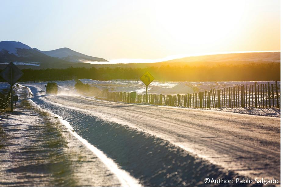
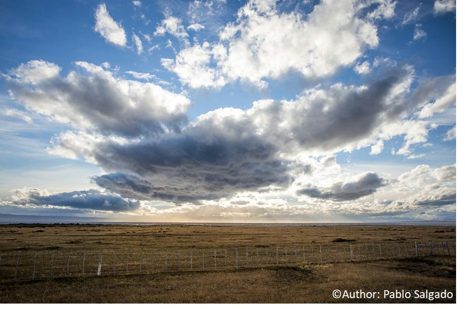 The region is composed of four provinces: Magallanes, Última Esperanza, Tierra del Fuego and Antártica Chilena. Together they make up part of the Chilean continental territory and the Chilean Antarctic territory, surprising visitors with significant climatic variations, which mean that in the same day there can be rain, sun, cold, heat or gusts of wind that can exceed 100 km / hr. achieving marked seasons of the year, which gives totally different landscapes with wonderful colors, lights and sensations all year round. A place where nature is overwhelming and full of contrasts, allowing a wide range of activities.
Special experiences of Magallanes.
Antarctica
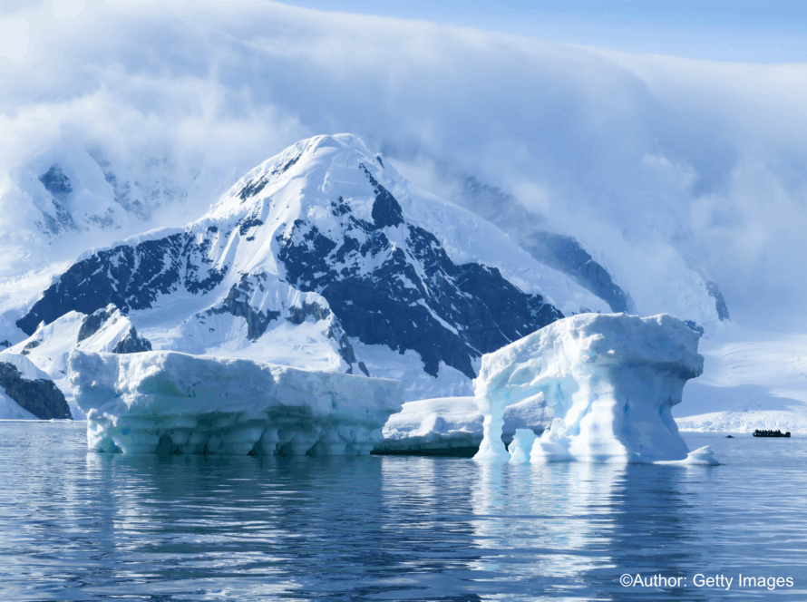
Chilean Antarctica, a territory between meridians 53° and 90°W, the 60°S parallel and the South Pole, which is part of the white continent, is one of the coldest places in the world. Its average annual temperature is -2.60 °C and precipitation reaches an annual average of 100 millimeters of snow. It is located about a thousand kilometers south of Punta Arenas and covers an area of 1,250,000 km², presenting very fragmented coasts.
Here you will find impressive landscapes of a unique continent; you can be meters away from the wildlife that lives there and know the daily life of people who come from different parts of the world to live in the name of science and research.
The waters where the Antarctic ice floats are the purest on the planet and move along the entire coast of Chilean Patagonia. In these extensions coexist the blue whale with the krill, the king penguins with the Weddell seals and the albatross with the petrels. These icy currents that dominate the air and the sea have made it possible to isolate this remarkable fauna from threats and extinctions. A place to admire and explore, dedicated to science and attracting more and more visitors, who must follow strict rules to maintain its pure state of conservation.
Puerto Natales and Torres del Paine
Travel through the most spectacular national parks and protected wilderness areas of Chilean Patagonia, astounding you with their natural beauty, endless trails and panoramic views.
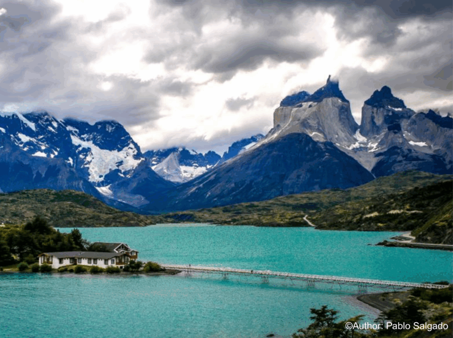
When you reach the province of Última Esperanza you will see that it is fragmented by a great diversity of channels, fjords and gulfs that make up, the national parks Bernardo O’Higgins, Torres del Paine and Kawésqar National Park, undoubtedly the great natural attractions of the area.
You cannot miss visiting Torres del Paine National Park, which has the particularity of concentrating the main ecosystems of Patagonia in one place: steppes, forests, glaciers, mountains, lakes and rivers, characteristics that allowed UNESCO to declare it a World Biosphere Reserve in 1978.
The obligatory step before visiting the diverse tourist attractions of the Province is the city of Puerto Natales, provincial capital and center for tourists operations, due to the proximity to the different mountain massifs and navigations to the Serrano and Balmaceda glaciers, both located within the Bernardo O’Higgins National Park, which with its 3,525,901 hectares is the largest in Chile.
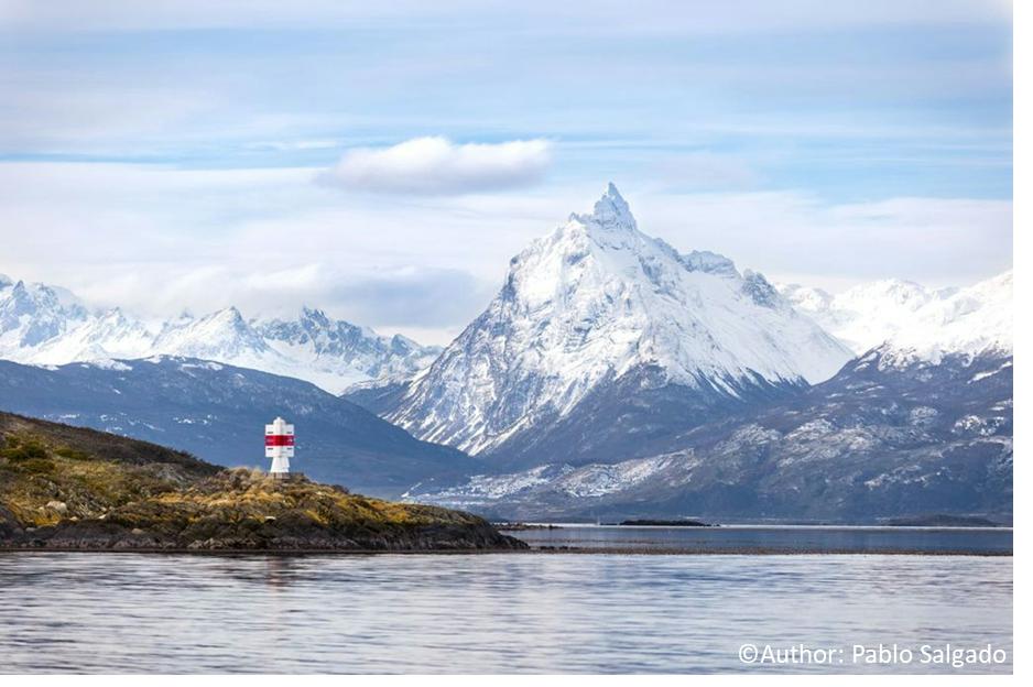
Navarino Island – Cabo de Hornos (Cape Horn)
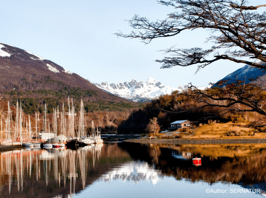
Enjoy the extreme nature of Navarino Island, formed by Magellanic forests, seas, lagoons and millenary ice, in the last place of the world.
In Navarino Island, nature undoubtedly imposes itself, the roads and trails of the island are a unique journey at the end of the world and the American continent. These show us an imposing geology carved by glaciations over two million years, a segmented landscape where sea and land come together towards the meeting of the Pacific, Atlantic and Antarctic oceans.
Part of its geography is covered by the Magellanic forest and steep mountains due to the presence of the Dientes de Navarino mountain range, while to the south there is an extensive peat plain that allows the existence of lakes and lagoons with abundant fauna.
Undoubtedly an iconic attraction is the mythical Cape Horn, which should be visited by sea, where mainly tourist boats land, if navigation and weather conditions allow it.
Its capital is Puerto Williams, the southernmost city in the world and the most important in the territory, which concentrates a large number of services.
Los Pingüinos Natural Monument Magdalena Island, Strait of Magallanes
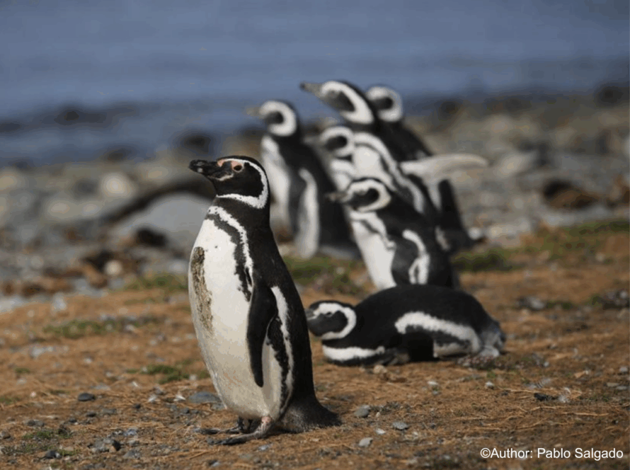
To get to the Magdalena Island, crowded by the Magellanic Penguin, you must take an excursion with one of the authorized companies. You will sail through the Strait of Magallanes for about 1.5 hours. This Natural Monument is a Protected Wildlife Area, where you will find one of the largest penguin colonies in Chile, whose population is estimated at 60,000 pairs of penguins which cohabit with seagulls and skuas. The penguin sighting season is between October and March.
Sailing with southern dolphins and whales
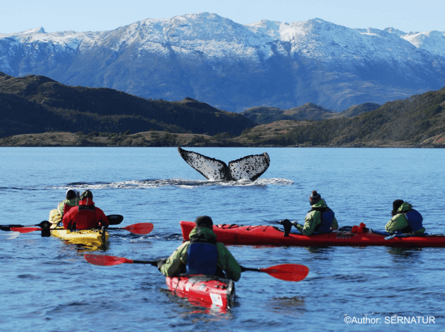
This excursion has become a must, both for visitors and for the inhabitants of the Magallanes Region, since it can be done by kayak or zodiac with specialized companies and with all the safety measures.
It is navigated in the area south of Punta Arenas in the Strait of Magallanes where all year round Common dolphin and Commersonii dolphin and in whale season (October – April) it is possible to see the magnificent humpback whale at a safe distance.
Magallanes National Reserve
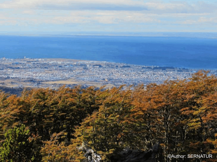
If you are looking for the best panoramic view of the Strait of Magallanes, this reserve is the right place. It has more than 60 kilometers of interpretive and hiking trails. It has a trail for tourists with reduced mobility and a flora trail, for those who wish to marvel at the variety and beauty of the native vegetation present in the place. It has about 20,000 hectares and is very close to Punta Arenas. It also has a privileged panoramic view of the city of Punta Arenas, the Strait of Magellan and Tierra del Fuego Island.
Why Punta Arenas?
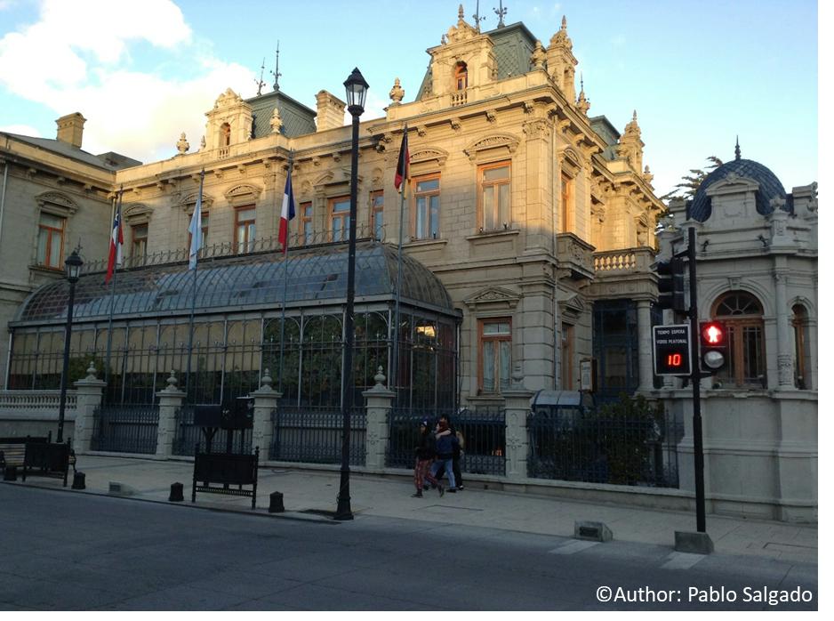
The Strait of Magallanes is the main natural route between the two largest oceans in the world, and its coasts are formed by the southern tip of the American continent and the island of Tierra del Fuego. On the shores of this mythical inter-oceanic passage is the city of Punta Arenas, which recalls the charm of a small European city in which a cosmopolitan population, an interesting history and modern services are mixed with a wide range of tourist attractions.
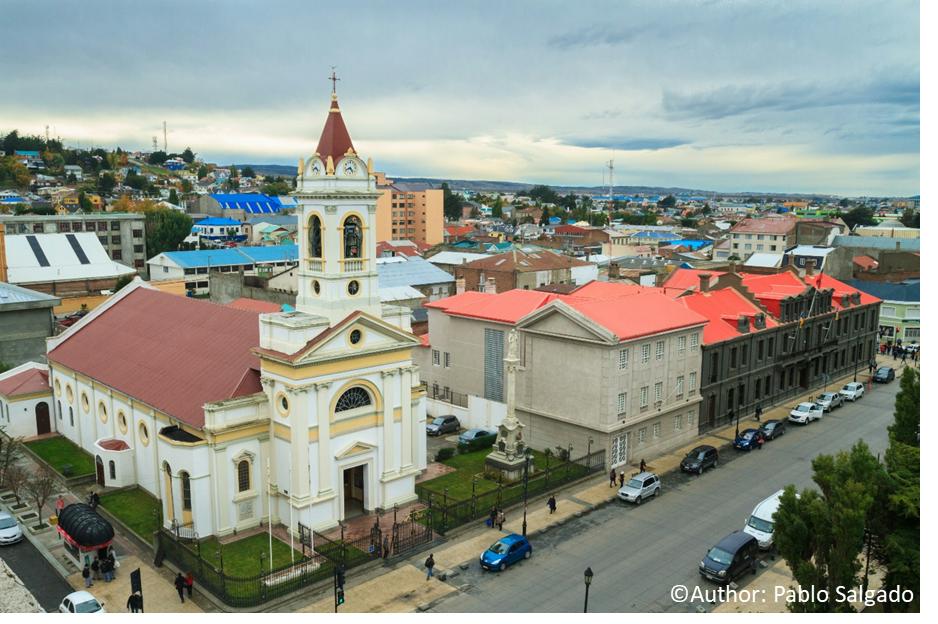
The Strait of Magallanes dates back to the 1500s, when Hernando de Magallanes discovered the strait that today bears his name. On its shores the nascent Punta Arenas was established in the mid-1800s. It was a penal colony and later became the largest center of commerce and supply for all cargo ships transporting cargo between the Pacific and Atlantic oceans until the opening of the Panama Canal on August 15, 1914. Currently it has become the main tourist center of Patagonia, offering a wide range of services and attractions of great level.
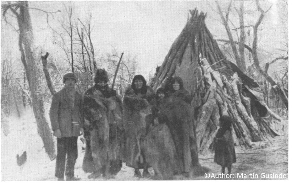
However, before the European arrival in the area, and for more than 6,000 years, these channels and their coasts had already been traveled and inhabited by the so-called sea nomads such as the Kawéskar and Yagan peoples, fishermen-gatherers who obtained food by hunting marine mammals, fishing and gathering mollusks and plants, abundant resources on the island coasts they occupied. However, before the arrival of these nomads of the sea, there were other peoples dedicated to hunting and gathering terrestrial animals and plants (about 12,000 years ago), who inhabited the area from the Strait of Magallanes to the north (Aonikenk), and the northern part of the Isla Grande de Tierra del Fuego (Selknam). All these ancestral peoples developed unique knowledge and skills that allowed them to efficiently take advantage of the resources of their hostile environment, especially coastal resources.
Magallanes Region and HABs
In the fishing sector, the region export large quantities of shellfish (sea urchins and southern scallop) and fish (such as southern Chilean hake and conger eel). Among the crustaceans, the southern king crab and the false king crab are particularly important for their culinary value, and the region is the main national exporter of both.
The first systematic observations of harmful algal blooms in the waters near Punta Arenas were recorded in the 1970s. These blooms were mailny identified because of their impact on shellfish harvesting activities and public health. However, previous records from the late nineteenth century describe two groups of Yaganes who died from symptoms consistent with paralytic shellfish poisoning after consuming mussels.